National Bike Week is always the third full week in May, but the entire month also lends itself to sharing the benefits of biking as a form of transportation and promoting bicyclist awareness. I sat down with Thomas Ruff of our Virginia Traffic Analysis & Planning group to learn more about how our roadways are being updated to accommodate cyclists and pedestrians alike.
 Thomas has been with Timmons Group for 10 years this summer. He graduated with a degree in Civil Engineering from the University of Virginia and his role in the Infrastructure division was his first job out of college. He began in the Transportation Design group and shifted into Traffic Analysis & Planning a few years ago as the need for traffic analysis grew in the industry.
Thomas has worked on a slew of projects in his time at the firm, but there are a few that stand out as being more significant for changes in promoting bicyclist safety over the years. In his role, he’s provided analyses and designs for projects like Chesterfield’s Countywide Sidewalk Master Plan, Charlottesville’s Barracks Road Improvements, Richmond’s Jefferson Avenue Streetscaping, Henrico County’s Facebook Data Center, and Hanover County’s Pole Green Road Widening to name a few.
Before we moved on to discussing projects in depth, Thomas gave me insight into a topic that is quickly becoming more applicable in the transportation and traffic world — The Road Diet.
So, what is a ‘road diet’? And no… it’s not a food consumer fad!
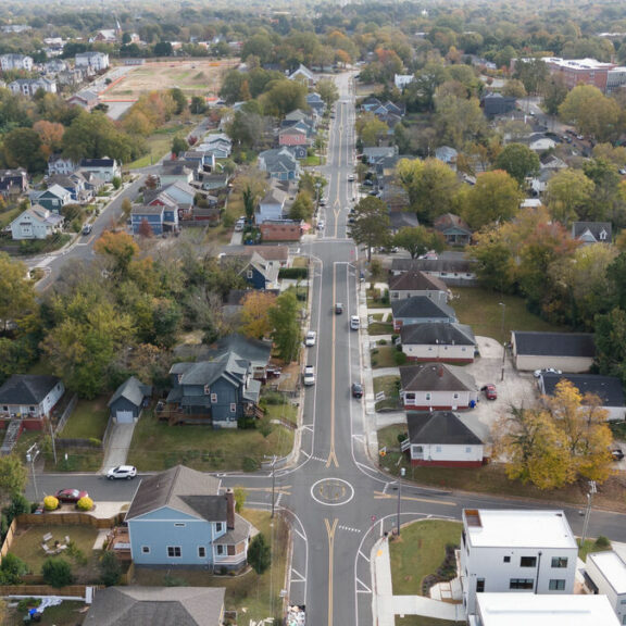
A road diet, as Thomas puts it, is an updated design for a paved road that incorporates bicyclists’ and pedestrians’ needs into the roadway’s function. “A normal roadway might have 2, 12-feet wide lanes, but some streets have upwards of 50 feet of pavement. When there’s that much pavement, cars move more quickly and can put cyclists and pedestrians at risk,” Thomas says. “The road diet is a safety solution for cars, cyclists, and pedestrians alike. When the road is more constricted, people don’t drive as fast.”
Thomas says from a traffic standpoint, road diets are becoming more important for both cities and more spread out counties. “If you look at our local counties’ and cities’ bike plans, they are wanting to incorporate ways to benefit everyone that uses a roadway, not just cars,” he says.
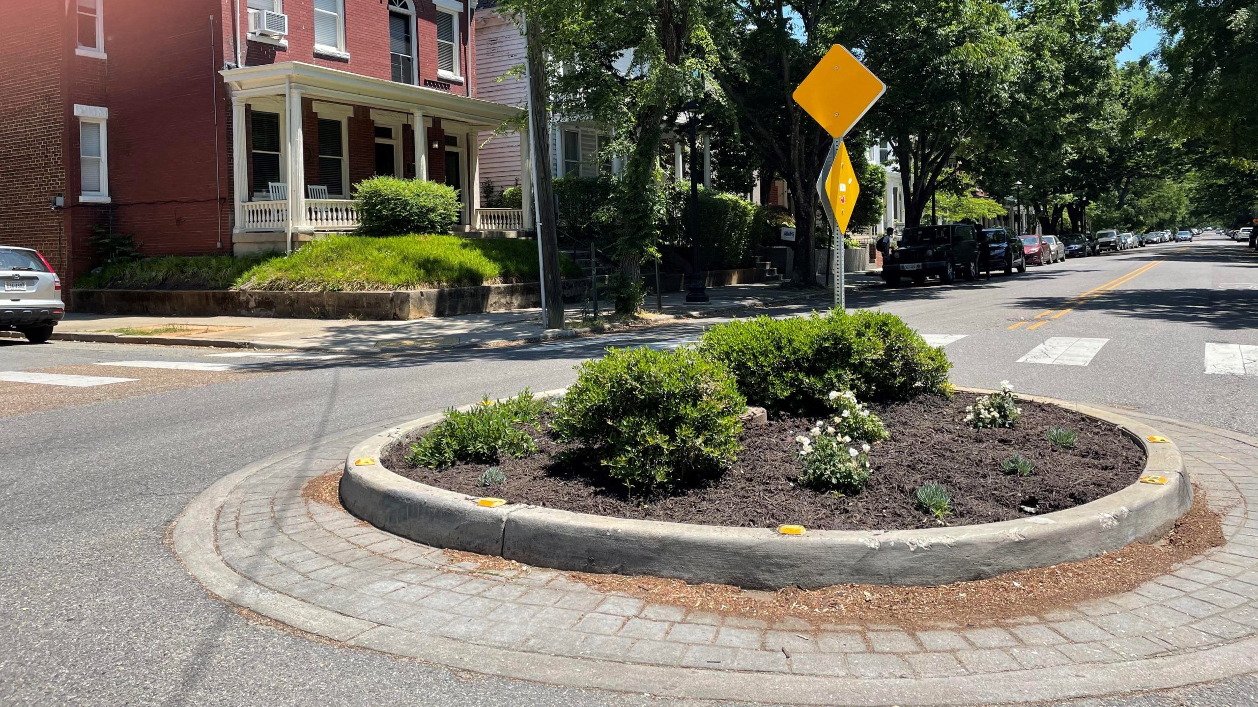
Thomas’s role in these updates is to analyze traffic patterns so a municipality can then update their pavement markings, increase dedicated bicycle and pedestrian space, or create buffers in between the road and bike lane. He runs analyses for speed, motorist volume, and truck percentage to determine what sorts of updates can be made to a paved area. “Sometimes it’s as simple as taking away lanes or turning a through lane into a turn lane by changing the markings on the street. Other times, we implement designs like small traffic circles, medians, shared use paths, or widened sidewalks as well,” Thomas says.
Have you ever wondered what those black tubes taped to the road are for? Yep, those are for traffic analysis! Thomas uses a combination of road tubes and cameras to collect data for his bicycle-based projects. “The road tubes are pneumatic and allow us to understand the volume of traffic, type of vehicles passing through, and the speed at which they’re traveling,” Thomas says. “We also use cameras at intersections to understand which direction vehicles are turning and what directions pedestrians and bikes are crossing the intersection.”
In addition to more tangible tools like the road tubes and cameras, Thomas also uses several programs to help him understand the data he’s collected. The main program he uses for this purpose is called Synchro. “It’s a tool that allows us to model real world roadway conditions, then make adjustments to the geometry (such as adding or removing a lane), change signal timing, or add pedestrian timings, and then compare the operational results.”
Thomas provided traffic analysis and design for the City of Richmond’s Bike Boulevard on Floyd Avenue. The updates took place on Floyd Avenue from I-195 to the VCU campus and included a lowered speed limit from 25 to 20 and installing speed tables, curb bump outs, and traffic circles. “The City chose Floyd Avenue for the Bike Boulevard because it was mostly residential and had multiple parallel routes. City planners knew that both residents and tourists could benefit from a dedicated bicycle space that would promote safe travel around and through these neighborhoods.”

In his role, Thomas has the opportunity to work on a vast array of traffic analysis projects. Another project in the pipeline includes updates for Southlake Boulevard and Johnston Willis Drive in Chesterfield County. “For the Southlake Boulevard analysis, we collected traffic data then analyzed sections of road and the intersections to see what kind of traffic we were working with and the speeds that people are traveling at regularly,” he says. The analysis also included the types of vehicles that are using the Boulevard.
“It’s imperative for both the City and the designers to understand what kinds of vehicles are using the road. Trucks require slightly larger lanes, so if most vehicles are trucks it might not be safe to incorporate a bike lane without some type of buffer or separate space. Fortunately for the Southlake project, we were able to perform a traffic analysis and determine that updates could be made to incorporate a bike lane for the County,” he says. The proposed improvements would fulfil a 2-mile portion of the Chesterfield County Bikeways and Trails Plan, from Huguenot Road to Huguenot Park, via Southlake Boulevard and Johnston Willis Drive.

As we close out National Bike Week and continue to celebrate National Bike Month throughout the remainder of May, Thomas reminds us of the importance of updating roadways to be accommodating to travelers other than cars and trucks.
So, next time you encounter a bike lane on a street, remember that it was carefully analyzed and designed with a purpose in mind: To help all travelers share the road! A well-connected network of bicycle infrastructure will create an environment that is safe and comfortable for all ages and abilities.


